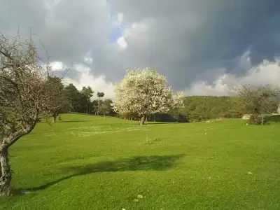
Aras Waterfall is a free natural spot in Osmangazi, Bursa, located 2 km walk from Ketenli Plateau, at an altitude of 1950 meters, where water from Uludağ's snowmelt cascades 15 meters high.
Aras Waterfall is located just next to Uludağ National Park, north of Ketenli Plateau, approximately 5 km from Soğukpınar Neighborhood, which is part of Bursa's Osmangazi district. Situated at an altitude of 1950 meters, the waterfall plunges 15 meters down through steep rocks, fed by a stream carrying snowmelt from the higher parts of Uludağ. Combined with the dense forest cover and mountain air, it becomes a highly attractive stop for those looking to escape the city's fatigue.
To reach the waterfall, after covering the approximately 30-kilometer road between Bursa and Soğukpınar, you take a 5 km stabilized road from the village to Ketenli Plateau, and from there, follow the marked trekking route for a 2 km walk to the waterfall. Progressing through pine and beech forests along the way offers an enjoyable journey even before arrival. The period between late May and early October stands out as the most suitable time to visit, both for open roads and high water flow.
Guide's Note

Aras Waterfall is considered by some visitors to be one of Bursa's most beautiful natural spots. However, as current reviews are quite limited, it is difficult to form a comprehensive general impression of the place.
Reaching the waterfall requires passing through forest roads. These roads have caused serious difficulties for some visitors; it is stated that there is a risk of falling into wooded areas on the left side in certain sections of the route. Descending and ascending to the waterfall can also be challenging, especially for families with children; one visitor reports that this round trip took approximately an hour and a half.
- Access road: Forest roads can be rough and narrow; caution is advised when driving.
- Risk of falling: At some points along the route, there are steep wooded areas on the left; the entire path is not safe.
- Visitors with children: The descent and ascent can be quite tiring; physical preparation should be considered before going with small children.
Best Time to Visit
The period between late May and early October is the most suitable for visiting Aras Waterfall. During this time, as the snows of Uludağ continue to melt, the waterfall's water flow remains high, presenting a much more powerful visual spectacle. In June and July, the greenery of the plateau also reaches its peak, making the scenery along the hiking route quite beautiful.
In winter months, the stabilized road leading to the plateau may close or become extremely challenging due to snow and ice. In early spring, the roads may not yet be fully open; therefore, it is advisable to check current road conditions from local sources before going in April and November.
How to Get There?
The most practical way to reach Aras Waterfall is by private car. From Bursa city center, an approximately 30 km road is taken via Osmangazi district to Soğukpınar Neighborhood. After the village, a 5 km stabilized road leads you to Ketenli Plateau. Since this section is a dirt and stone road, high-clearance or 4x4 vehicles should be preferred; low-profile vehicles should proceed with caution.
After arriving at Ketenli Plateau, follow the marked trekking route in the northern direction for approximately 2 km to reach the waterfall. Direct access by public transport is quite limited; renting a car from the city center or joining organized nature tours might be an easier alternative.
Route Suggestion
If you want to fully appreciate your visit to Aras Waterfall, it is recommended to set off early in the morning. After arriving at Ketenli Plateau, you can take a short break at the plateau itself and explore the surroundings, then follow the marked trekking path down to the waterfall.
Instead of using the same route for the return, if you are knowledgeable and an experienced hiker, alternative trails within Uludağ National Park can also be considered. However, as the descent to the waterfall from the Küçük Zirve (Small Summit) side is known to be quite challenging and steep, this route is not recommended for inexperienced visitors. Don't forget to bring enough water, snacks, and appropriate hiking shoes.
Photography Spots
Aras Waterfall, with its 15-meter drop and surrounding rocky structure, offers an excellent frame for photography. By positioning yourself directly in front of the waterfall, you can use long exposure technique to make the water flow appear silky; a tripod is essential for this.
In the early morning, the light filtering through the forest illuminates both the waterfall and its surrounding greenery in a much more dramatic way. Along the hiking route, it is also possible to capture panoramic views of Ketenli Plateau; especially the valley view that opens up as you descend from the plateau to the waterfall is ideal for wide-angle lenses.
What to Eat, Where to Eat?
There are no food and beverage facilities immediately around the waterfall. Some small businesses offering village breakfast in and around Ketenli Plateau may operate seasonally; however, it is a much healthier approach to bring enough food and drinks with you rather than relying on this.
On the way back, you can try the flavors of Bursa cuisine at local restaurants in Soğukpınar Neighborhood or Osmangazi district center. Bursa's famous İskender kebab, various types of meatballs, and candied chestnuts are among the must-try delicacies in this region.
Things to Consider
Since Aras Waterfall is located at an altitude of 1950 meters, weather conditions can be much more variable compared to the city. Even in mid-summer, cool or even cold weather can be a surprise on the plateau; therefore, always bring a raincoat or a light jacket.
Although the hiking route is marked, it is a secluded mountain path; make sure your phone is fully charged and check offline map applications beforehand. The rocks around the waterfall can be wet and slippery; sturdy hiking shoes are a must. To protect the natural area, take your trash back with you.
This content originates from neresigezilir.com.tr and may not be copied without permission.
Aras Waterfall Videos
Aras Waterfall videos load when you open this section to keep the page fast.
Show videos
FAQ
Updated: