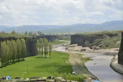
Noah's Ark is a boat-shaped natural land formation located on the southern slope of Mount Ararat, between the villages of Telçeker and Üzengili; discovered in 1959, associated with the legend of Noah's Flood in the Holy Bible, and registered as a cultural and natural asset requiring protection since 1987.
Opposite Mount Ararat, there is a slope south of the Doğubayazıt-Gürbulak road. On this slope, located between the villages of Telçeker and Üzengili, the earth forms a strange, boat-like silhouette: a mass measuring 165x50x13 meters, narrow at the bow and widening in the middle. It is said to match the dimensions of Noah's Ark mentioned in holy books, which is why the site is commonly referred to as "Noah's Ark" by locals and visitors alike.
The formation was first noticed on September 11, 1959, by map captain İhsan Durupınar while examining aerial photometric maps of the region. Since then, American researchers, notably James Irwin, as well as Turkish scientists from Atatürk University and MTA, have conducted studies in the area. It has been determined that the mass is composed of a much more durable material than the surrounding soil and has maintained its shape for years on a slope prone to constant landslides. In 1987, a board affiliated with the Ministry of Culture and Tourism declared the area a "movable cultural and natural asset requiring protection"; today, it holds the status of a natural site and open-air museum.
The experience for visitors is twofold. On one hand, there is the opportunity to see a truly extraordinary geological formation, and on the other, to delve into a religious and legendary narrative. In comments, some visitors state that they find the place spiritually impressive, while others write that the small museum section and the surrounding walking opportunities need to be developed. The view of Mount Ararat along the road, especially at sunset, is repeatedly mentioned in comments as a prominent detail.
Guide's Note

What is Noah's Ark, Why is it Important?
On the slope between the villages of Telçeker and Üzengili, a boat-shaped mass distinctly different from the surrounding soil stands. This formation, noticed by İhsan Durupınar in aerial photographs in 1959, has since attracted both scientists and religious visitors. It has been determined that the material of the mass is more durable than the surrounding soil and has maintained its shape for years on a slope prone to constant landslides. Whether this is truly the ark that landed after Noah's Flood or an interesting geological coincidence is still debated; despite this uncertainty, the area has been protected as a natural site since 1987.
Best Time to Visit
Since the region is at a high altitude, winter months can be challenging in terms of road conditions. There are visitor comments indicating that wild flowers bloom in the surrounding area during the summer months, especially in July. The May-September period stands out as the most comfortable time for both road conditions and scenery. Those who visit during sunset hours report that the view behind Mount Ararat takes on a different character.
How to Get There?
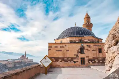
From Ağrı city center, it takes approximately 1.5-2 hours by car to Doğubayazıt. To reach Noah's Ark from Doğubayazıt center, turn towards Telçeker-Üzengili villages from the road leading to the Gürbulak border gate; the site is 3.5 kilometers from the main road. Since public transportation options are limited, renting a private car or going with a local tour is the most practical way. It is logical to add Ishak Pasha Palace to the same day's visit list, as the two points are close to each other.
How Much Time Should Be Allocated?
The area itself does not require an extensive tour; 1-1.5 hours is sufficient for viewing the remains, visiting the small visitor center, and taking a photo break. However, the round-trip travel time from Doğubayazıt should also be taken into account. It is possible to fit Ishak Pasha Palace, Doğubayazıt center, and Noah's Ark into the same day.
Things to Consider
The area is located near the Iranian border; some visitors describe this as part of the scenery, a point overlooking the border line. There is a recurring criticism in comments: the small museum section is deemed inadequate, and there are no organized walking routes around the remains. One visitor wrote that the area is not sufficiently valued, and its protection and promotion are limited. Adjusting expectations accordingly can reduce disappointment.
Good Spots for Photography
The point where the boat silhouette is most clearly visible is the viewing area right next to the visitor center. Shots with Mount Ararat in the background stand out in the photos shared by visitors here. The color of the light changes during sunset hours, and some visitors have chosen to spend the night in the visitor center's parking lot to not miss the morning view.
Other Stops in the Vicinity
Noah's Ark alone does not fill a whole day, so combining it with nearby points is logical. Ishak Pasha Palace in Doğubayazıt is another must-see stop in the same region. Since it falls within the borders of Mount Ararat National Park, those planning mountaineering or trekking can extend their route accordingly.
This content originates from neresigezilir.com.tr and may not be copied without permission.
Noah's Ark Videos
Noah's Ark videos load when you open this section to keep the page fast.
Show videos
FAQ

Updated: