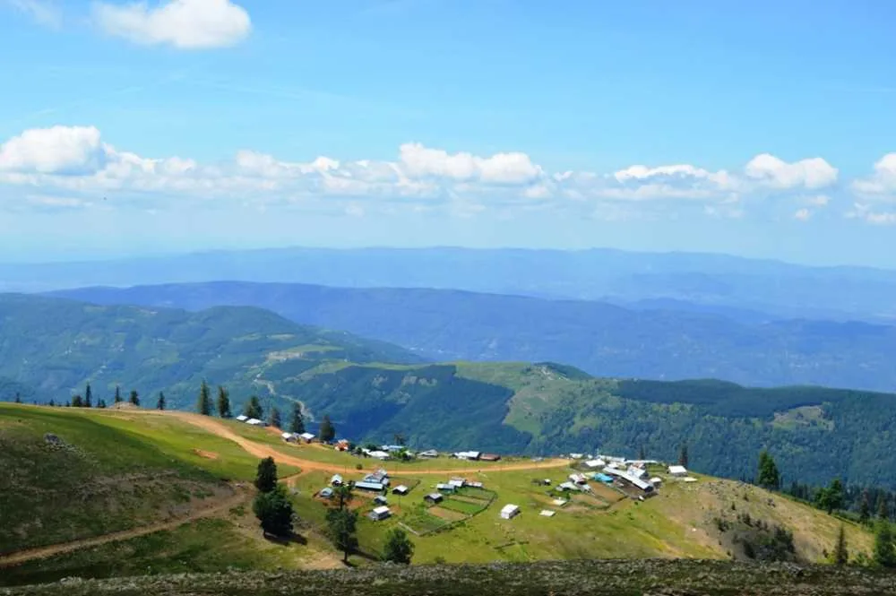
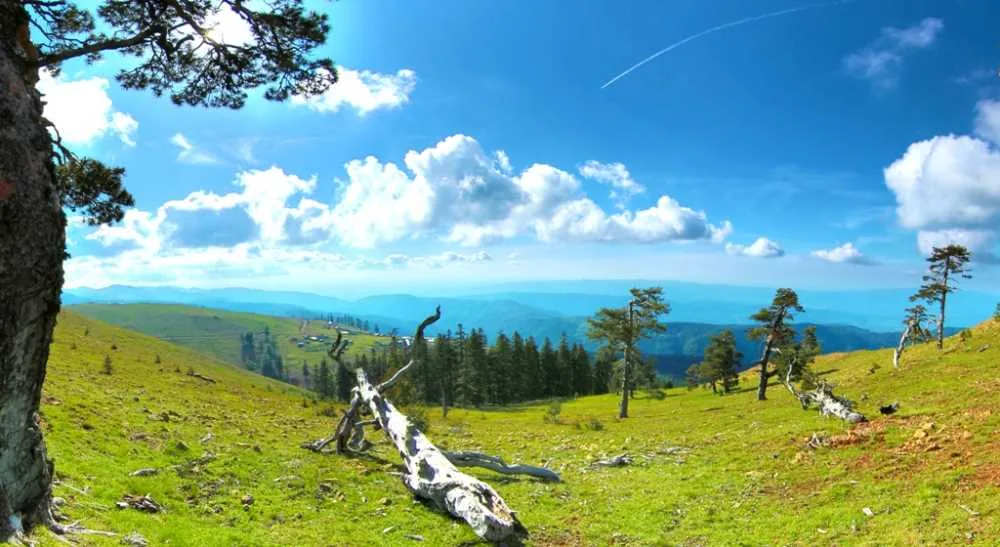
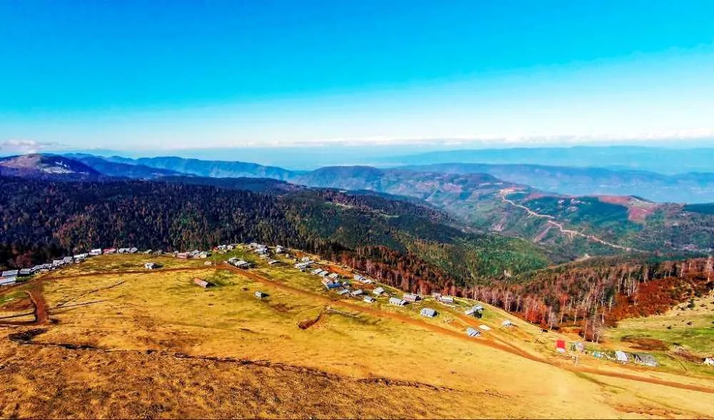
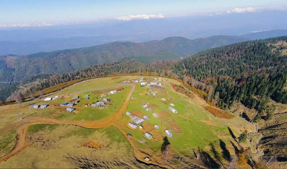
Kardüz Yaylası, Düzce'nin Gölyaka ilçesinde 1830 metre rakımda yer alan, geniş çayırları ve çam-göknar ormanlarıyla kamp, trekking ve gün doğumu izlemeye uygun uçsuz bucaksız bir yayla alanıdır; giriş ücretsizdir.
Kardüz Plateau is one of the highest points in Düzce province, located 28 kilometers from Gölyaka district center and 48 kilometers from Düzce, at an altitude of 1830 meters. Covering an area of 180 hectares, the plateau has been declared a Culture and Tourism Protection and Development Zone. From above, plateau houses are scattered among the meadows, surrounded by beech and fir forests.
The real attraction here is the summit. On a clear day, Sakarya, Bolu, and Düzce can be seen simultaneously, and even the Akçakoca coastline can be distinguished in the distance. Sunset and sunrise hours are the most recommended times. Staying around the mosque at the summit provides shelter from the wind and solves water and toilet needs. Since there is little light pollution at night, some people watch the Milky Way with the naked eye. The thyme-scented air is also a detail frequently mentioned by visitors.
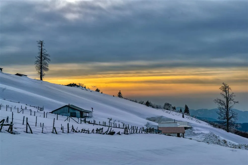
There are no hotels on the plateau. Flat areas suitable for tent and caravan camping are predominant. The 24-kilometer trail between Aksu Stream and the plateau attracts attention with its endemic flora and wildlife but requires good physical condition and navigation experience. Even in summer, temperatures can drop to 7-8 degrees Celsius at night, and those who go without a jacket say they get cold. In winter, activities such as skiing, snowmobiling, and ATVs come to the fore.
Guide's Note
When to Visit
Summer months (June-September) are the most suitable period for hiking and camping. In August, daytime temperatures can remain around 15 degrees Celsius, dropping to 7-8 degrees at night. It's refreshing for those escaping summer heat, but unprepared visitors will get cold. In winter, the snow cover allows for activities like skiing and snowmobiling; confirm conditions before setting out during this period.
How to Get There
It is approximately 48 kilometers from Düzce city center via Gölyaka district, and 28 kilometers from Gölyaka center. Most of the road is asphalt, the last 11 kilometers are stony and rough dirt road. It is possible to reach with a sedan car by driving slowly. After heavy rain, some sections of the road can deteriorate as they are in a flood-prone area. If you plan to continue into the forest from the plateau, choose a day without rain.
How Many Hours to Allocate
3-4 hours are sufficient for a day trip picnic and walk. Those who want to see the sunrise or sunset prefer to stay overnight near the summit, around the mosque. Being sheltered from the wind and offering water and toilet facilities are factors in this choice. Those who want to complete the 24-kilometer trail between Aksu Stream and Kardüz need to plan for a full day.
Route and Activities
Upon arriving at the plateau, first explore the wide meadows and fir forests, then climb to the summit to find the point where Sakarya, Bolu, and Düzce can be seen simultaneously. On a clear day, even the Akçakoca coast can be distinguished in the distance. Trekking trails are rough, so comfortable shoes are required. In winter, snow sports, and in summer, activities such as jeep safari, mountain biking, and horseback riding can be done.
Where to Stay
There are no hotels within the plateau, but there are wide flat areas suitable for tent or caravan camping. The area beyond the plateau houses is particularly preferred. The vicinity of the mosque near the summit is recommended by those staying overnight as it provides shelter from the wind and meets basic needs. If you plan to stay overnight, bring camping equipment, sufficient water, and your jacket.
What to Eat, Where to Buy
There are no developed markets or restaurants around the plateau. The most practical solution for picnic and camping food and drink needs is to get them from Gölyaka or Düzce city center. The scent of thyme in the air is a detail frequently mentioned by visitors, coming from the region's natural flora.
Things to Pay Attention To
The road is full of gaps and potholes, and dust is a serious problem; it can get so dusty that you can't see the car in front. The altitude difference can reach up to 150 meters even within the plateau itself, and two-dimensional maps can be misleading. The sun can be scorching during the day, and it gets cold at night. Layered clothing is the safest. The area generally remains clean thanks to those who don't leave trash; please do the same.
Best Spots for Photography
The summit is the most preferred spot for both sunrise and sunset shots, offering a view where three provinces can be seen simultaneously. The formation of a sea of clouds in the early hours is also a scene sought after by photographers. Wide meadows and fir forests in the background are preferred for daytime landscape photos.
This content originates from neresigezilir.com.tr and may not be copied without permission.
Kardüz Plateau Videos
Kardüz Plateau videos load when you open this section to keep the page fast.
Show videos
FAQ

Updated: