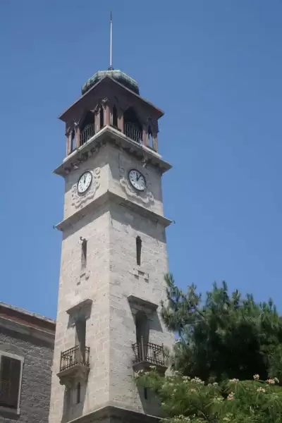
Antandros Ancient City is an ancient Troas city located on Kaletaşı Hill in Balıkesir's Edremit district, controlling the trade route between Mysia and Troas; known for its mosaic villa floors and archaeological excavations, entrance is free.
Antandros is an ancient Troas city founded on the foothills of Mount Ida (Kaz Dağı) facing the Aegean Sea, just behind the Gulf of Edremit. Situated on Kaletaşı Hill, approximately 2 km east of Altınoluk town, the city, thanks to its geographical location, controlled the land route between Mysia and Troas and the timber trade from Mount Ida throughout history. Mentioned in ancient sources for its high-quality timber used in shipbuilding, Antandros functioned as a significant trade and port center in this corner of the Aegean.
Excavations at the site are primarily carried out by Ege University; the unearthed mosaic villa floors, fountain structures, and architectural remains reveal the city's history extending back to the Roman period. The impressiveness of the mosaics is often highlighted by visitors; comments also emphasize that the historical context of the area is much better understood during guided tours. On the other hand, some visitors state that they missed the way due to insufficient signage and had to park on the main road and walk because vehicle entry is not possible. The site can sometimes be closed during excavation periods; therefore, it is important to confirm the current status before visiting.
Guide's Note

Where is Antandros, What Does It Mean?
Antandros is a city founded in ancient geography at the southern border of the Troas region, where it intersected with Mysia. It is located on Kaletaşı Hill, just east of the Altınoluk town, which is part of today's Edremit district. When viewed from the North Aegean coast, it is situated on a strategic elevation on the slopes of Mount Ida (Kaz Dağı) extending towards the sea.
In ancient sources, the most important economic resource of the city is stated to be timber cut from Mount Ida, especially used in shipbuilding. This trade made Antandros an important stop in the region for centuries. Archaeological findings reveal that the city continued to be a vibrant settlement during the Roman period.
When to Visit?
April – June and September – October are the most suitable periods for visiting Antandros. During these months, the climate of the Edremit Gulf is mild, walking on the hill is not tiring, and your chances of coinciding with active excavation periods increase.
In July – August, temperatures can rise to 35 degrees Celsius and above; sun protection is essential when exploring the mosaics and ruins in the open area. In winter months, the area can sometimes be closed, so it is recommended to get information beforehand.
Important warning: The area may remain locked when excavation work is ongoing or when no official is present. Some visitors report being unable to enter because there was no guard. It is strongly advised to confirm the current status before going.
How to Get to Antandros?
The most practical way to reach Antandros is by private car. From Edremit city center, follow the coastal road towards Çanakkale; approximately 2 km after Altınoluk, you will reach the archaeological site on the roadside. You can search for 'Antandros Ancient City' on map applications.
Vehicle entry to the area is not possible; visitors have to park on the main road and walk in. Since road signs are insufficient, some visitors may get lost; saving the route beforehand will make your job easier.
Those wishing to come by public transport can use the minibuses on the Edremit – Altınoluk line; however, you may need to walk a certain distance as there is no stop directly in front of the archaeological site.
Photo Spots
The most captivating photographic subject at Antandros is the mosaic villa floors. Geometric and figural mosaics from the Roman period offer powerful shots in natural light; side lighting in the morning hours accentuates the mosaic texture.
The panoramic view combining the Gulf of Edremit and Mount Ida, offered by the elevation advantage of Kaletaşı Hill, also attracts photography enthusiasts. Ancient fountain structures and stone wall remains create interesting frames for architectural photography.
How Much Time Should Be Allocated for a Visit?
Compared to large-scale ancient cities, Antandros is a relatively small archaeological site; it can be comfortably explored in 1 to 1.5 hours. This duration may extend slightly during guided tours; visitors state that guided tours enable them to understand the area much better.
You can combine Antandros with Altınoluk beach or Edremit bazaar to create a half-day itinerary.
Route Suggestion: Combine with Edremit Gulf
Planning Antandros as part of an Edremit Gulf trip is the most logical approach. You can take a walk on Altınoluk beach in the morning, finish breakfast, and then proceed to the archaeological site. In the afternoon, there will also be time to explore olive oil products and local delicacies in Edremit bazaar.
For those who wish to add Assos Ancient City (Behramkale) to the same travel program, Antandros is a natural stopover on the Çanakkale route.
Things to Consider Before Visiting
Considering a few practical points before visiting Antandros will prevent disappointment:
Open or closed? The area is kept locked when excavation work is ongoing or when no official is present. Some visitors report having to turn back at the gate after traveling for hours. Before going, check antandros.org or the Antandros Association.
Vehicle parking: Vehicle entry to the area is not possible; you need to park on the main road and walk. Due to insufficient road signs, finding the entrance point can be difficult; save the coordinates to your map application beforehand.
Physical preparation: Since the area is on a hill, comfortable walking shoes and plenty of water and sunscreen are essential in summer.
This content originates from neresigezilir.com.tr and may not be copied without permission.
Antandros Ancient City Videos
Antandros Ancient City videos load when you open this section to keep the page fast.
Show videos
FAQ

Updated: